


Pictured Rocks National Lakeshore
Pictured Rocks National Lakeshore is a U.S. National Lakeshore on the shore of Lake Superior in the Upper Peninsula of Michigan, United States. It extends for 42 miles (67 km) along the shore and covers 73,236 acres (114 sq mi; 296 km2). The park has extensive views of the hilly shoreline between Munising and Grand Marais in Alger County, Michigan, with picturesque rock formations, waterfalls, and sand dunes.
Pictured Rocks derives its name from the 15 miles (24 km) of colorful sandstone cliffs northeast of Munising. The cliffs reach up to 200 feet (60 m) above lake level. They have been naturally sculptured into a variety of shallow caves, arches, and formations resembling castle turrets and human profiles. Near Munising, visitors can also visit Grand Island, most of which is included in the separate Grand Island National Recreation Area.
The U.S. Congress designated Pictured Rocks the first National Lakeshore in the United States in 1966. It is governed by the National Park Service (NPS), with 22 year-round NPS employees as of May 2006, and received 476,888 visitors in 2005.
Links
Images Gallery
-
 Chapel Rock
-
 Bridalveil Falls emptying into Lake Superior
-
 Miners' Castle after one turret collapsed in April 2006[1]
-
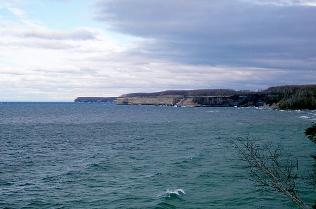 Pictured Rocks in the distance.
-
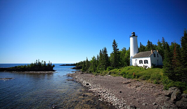
 Au Sable Light, built in 1874 after numerous shipwrecks
-
 Indian Head as seen during Pictured Rocks Cruises
-
 Rock arches and sea caves are popular with kayakers
-
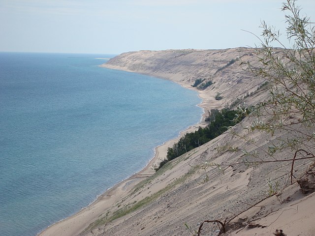 Grand Sable Dunes
-

-

-

-
 View of the dunes with Lake Superior in the background
-
 A view of the Grand Sable Banks looking east from the logslide location
-
 A view of the former logslide site from the top of the banks
-
 A view of the dunes overlooking Grand Sable Lake
-
 A tour boat at Pictured Rocks
-
 An ice climber explores ice formations near Miner's Falls, Pictured Rocks National Lakeshore
-

-

-

Comments
-
Beauty. Hiking, swimming, sightseeing and more, Mother Nature offers a grand and inspiring experience at Pictured Rocks. Be aware, however, everything is very spread out. Come with a plan. Explore. Find something awesome. There's plenty to do for hikers, boaters, swimmers, and those who just want to drive to the overlooks. For those who want to go further and see the not-so-obvious hidden places, there's plenty to do as well.
a week ago -
This was wonderful! Such beauty! There are so many ways to see Pictured Rocks. You first need to decide what type of traveler you are. Do you want to sit and see pretty views from a boat with a guide speaking over a microphone or do you want to be active and kayak? Or do you want to do it all yourself and drive around to certain locations and see from the shore? You need to get out into the water to see the beauty of the rocks. You can spend about $40 per person to see it from a motorized boat which is what we did. They did a great job providing information as we traveled, but I found myself wishing we had rented a pontoon boat or rented kayaks. I felt we may have enjoyed kayaks or pontoons more. The pontoons and kayaks would have cost 1.5 or 2 times as much. All get your out there, but which would be the most fun for your group and their abilities? Lots of options for whichever you choose.
2 weeks ago -
Amazing rock formations. I took the cruise, but I plan on coming back and exploring more of the shoreline by foot. Drove 2 hours from mackinaw (total over 6 hours from metro detroit) and it was well worth it!
a week ago -
Such an incredibly stunning experience. And the north country trail is a dream for any nature lover! It explores along the entire pictures rocks coast. Absolutely beautiful trail along the coast with awesome vista points, someday I want to do the entire trail. Just did 6 miles one way so 12 miles total and that was awesome. Can imagine what the rest of the trail is like :)
3 weeks ago -
Beautiful place where you can do so many things. We were just driving through and stopped for a couple of hours but would love to come back and do a kayaking tour and explore more of the areas. Multiple places to get different National Passport stamps. Beautiful areas to explore. Great, informative Park Guides.
a week ago -
Beautiful, post card perfect!!! Lovely beaches! You must do the cruise and spend the sunsets at the beach!
6 days ago -
What an unbelievable place! Went last fall for the changing of the leaves it was absolutely epic and full of color. It's very cloudy and rainy a lot of the year but it is definitely worth it. There are several five to three and seven mile hikes and one 12 and one 25 pretty decent terrain no water supplies on the way. The signage on the long trails could be much better it could be much better marked. The picturesque walk along the lake on the cliffs is truly stunning this is my fourth trip back first time in the spring the least busy that I've ever seen the park and it is just as beautiful. Just remember if you're from south of Michigan they are about 6 weeks behind in the spring and gets cold fast in the fall it gets cold but there is plenty of firewood great campgrounds I suggest Beaver lake campground campsite number five has the most space. Add this on your places to go and things to see no entry fee. But book campsite 6 months of advance. Best time to see the leaves changing is really at it's best around the last week of September to the end of October.
4 weeks ago -
PRNLS is a jewel situated in the center of an international treasure: the upper peninsula (MI). Solid hikes all along the shoreline. Trails leading for >32 miles through many historic sides along the curving cliffs of Superior. Be careful to scrub your shoes before entering these sacred protected grounds. Mother Earth 🌍 thanks you.
2 months ago