


Source:
Wikipedia
Devil's Slide (Utah)
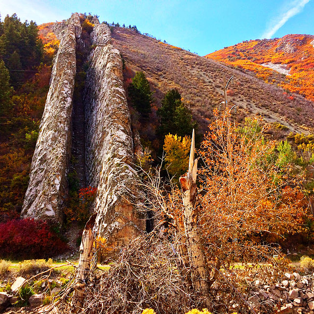
Devil's Slide is a geological formation located near the border of Wyoming in northern Utah's Weber Canyon, near the community of Croydon in Morgan County, Utah, United States. The slide consists of two parallel limestone strata that have been tilted to lie vertical, protruding 40 feet (12 m) out of the mountainside. Intervening layers have eroded more quickly, forming a channel some 8 feet (2.4 m) wide running hundreds of feet down the mountain.I-84 runs right past Devil's Slide, which can be clearly seen from the road. The Weber River flows between the formation and the freeway. There are parking areas on both sides of the highway for viewing the slide.
- 1 Gallery
- 2 References
- 3 External links
Links
Images Gallery
-
 October 2013
-

-

-

-

Comments
Share your experience with others and write the first comment about the location
Source:
Wikipedia
Devil's Slide (Utah)
➴ Coordinates:
41° 3‘ N, 111° 32‘ W
Tags
Accessibility
Children
Weather
23. August 2025
N/A °
N/A
N/A
N/A
Wind
N/A k/h
Humidity
N/A
Visibility
N/A km