


 at milepost 16 September 2011")

Source:
Wikipedia
Pikes Peak Highway
The Pikes Peak Highway is a 19-mile (31 km) toll road that runs from Cascade, Colorado to the summit of Pikes Peak in El Paso County, at an altitude of 14,115 feet (4,302 m). It is at least partially open year-round, up to the altitude where snow removal becomes excessively difficult.
The rate structure varies depending on time of year and ranges from $10 per adult and $5 per child throughout winter up to $50 per carload (5 passengers or less) with discounts on additional passengers.
Links
Images Gallery
-
 Entrance to the Pikes Peak Highway
-
 A view of the highway as it nears the summit
-
 Downhill drivers have to check the brake temperatures of their vehicle at this station
-
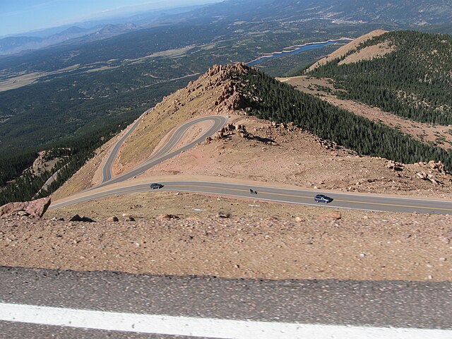 The winding Pikes Peak Highway, looking down from 13,000 feet (3,960 m) at milepost 16 September 2011
-
 Suzuki Grand Vitara at the 2006 Race to the Clouds
Comments
Share your experience with others and write the first comment about the location
Source:
Wikipedia
Pikes Peak Highway
➴ Coordinates:
38° 54‘ N, 105° 0‘ W
Weather
2. Januar 2026
N/A °
N/A
N/A
N/A
Wind
N/A k/h
Humidity
N/A
Visibility
N/A km