


Langtang National Park (लाङटाङ राष्ट्रिय निकुञ्ज)
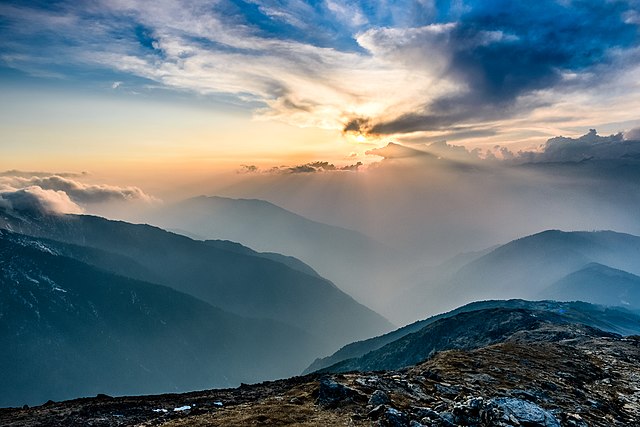
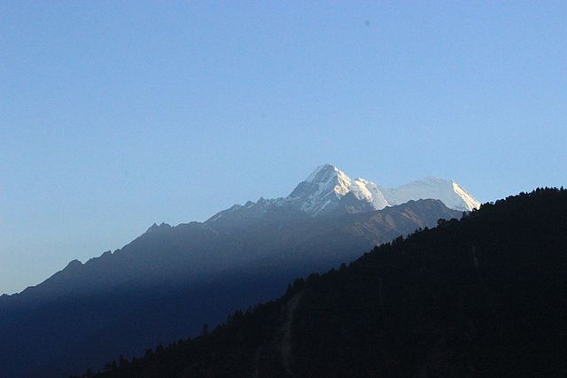
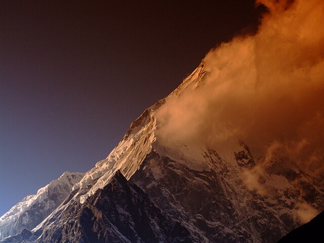
Langtang National Park was established in 1976 as Nepal's first Himalayan national park and the country's fourth protected area. It exceeds an elevation range of 6,450 m (21,160 ft) and covers an area of 1,710 km2 (660 sq mi) in the Nuwakot, Rasuwa and Sindhulpalchok Districts of the central Himalayan region encompassing 26 village communities. In the north and east it is linked with Qomolangma National Nature Preserve in Tibet Autonomous Region.
The eastern and western boundaries follow the Bhote Koshi and the Trishuli river, respectively. The southern border lies 32 km (20 mi) north of the Kathmandu Valley.The Gosainkunda lake is located at an elevation of 4,300 m (14,100 ft) inside the park. The Dorje Lakpa range at 6,988 m (22,927 ft) bisects the park from west–east to south–east. The summit of Langtang Lirung (7,245 m (23,770 ft)) is the highest point in the park.Langtang National Park is part of the Sacred Himalayan Landscape.
- 1 History
- 2 Climate
- 3 Flora and Fauna
- 4 References
- 5 External links
Links
Images Gallery
Comments
-
First trekking of my life😍😍 it was simply amazing. You will see 360° view of mountains. Langtang Valley is amazing. Kyanjin Gompa is the last place with hotels. Local people are so helpful. You get fresh n good Nepalese food. Blue sky, clean water of Langtang river👌👌You are going to love it. Don't carry much luggage, food is available. You may carry high calorie but low weight foods such as energy bar, dry fruits and ORS is the most needed thing. You can't compromise with the quality of shoes. Knee cap and trekking stick provide you great support
a month ago -
-
Best trekking route and best tourism destination in Nepal . Rich with flora and fauna. Great view of mountains and friendly local people. Nepal's first Himalaya national park and it was established in 1976. This national park is a great place to visit where you would enjoy with beautiful view of rivers, forest, landscape, animals, birds and different faces of people and their culture. "Naturally Nepal- Once is not enough". Rare animal Red panda and other hilly wildlife is found here.
6 months ago -
I do have best experience of my life, the worm hospitality still exists here. This treeking was lifetime experience and memorable
3 months ago -
Really cool place and some parts are accessible to vehicles too. Road is mostly good till Ramche.
2 months ago -
-
It was established in 1976 to conserve the unique flora and fauna of the region. It is the nearest national park of the capital Kathmandu in the Central Himalayan Region. The 1710 sq. km. of the park extends over parts of Nuwakot, Rasuwa, and Sindhupalchok districts in the southern mountainous terrain of the Nepal-China (Tibet) border. In 1998 an areas of 420 sq. km in and around the park declare as a buffer zone. The park represents a meeting point between indo-Malayan and Palearctic realms, and holds a rich biodiversity. Buffer zone management is a joint venture between the park office and the local communities. Local communities have a decision-making role in the management of such areas. Additionally, the local communities or the BZ receive 30 to 50 % of the park revenue for the better management of natural resources to ensure a sustainable supply of resources and community development Climate: September through May offers a variety of natural splendors, from lush temperate river valleys with screeching langur to spectacular old growth forest and glacial-craved cliffs rimmed by snow-covered peaks. The weather is also relatively dry except January-February when one may come across snow.Autumn is the best time to visit the Park. By April bursts of red, pink, and while rhododendrons stretch into towering canopies of fir and oak forests. Advent of warm weather makes the Yak and Chauri herds ascend to higher elevation, making occasional camps in the pasturelands, to follow years of tradition. From June to august, skies are heavy with monsoon rains. During August, a lively festival at Gosaikunda Lake attracts thousands of Hindu pilgrims and September witnesses’ spectacular display of wild flowers, while livestock herds, once again, return to lower pastures. #ontopofamountain #yoga #meditation #camp
4 months ago -