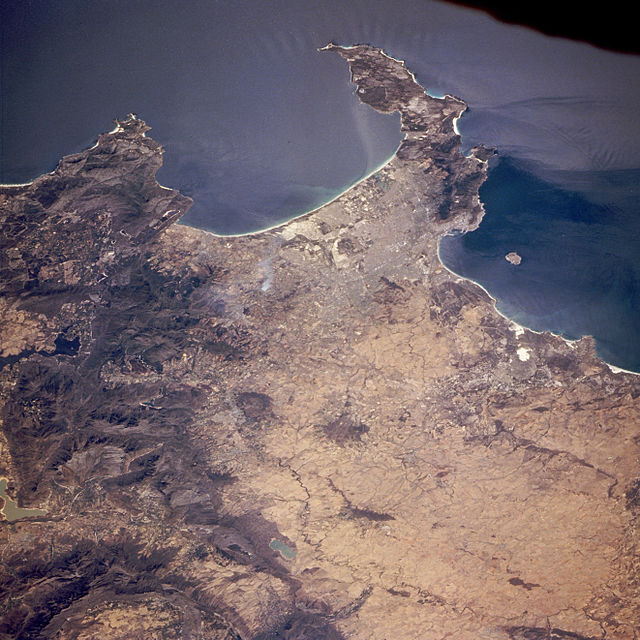
 and Table Bay, with Robben Island (left). Compilation produced by NASA from Landsat and SRTM data. Vertical scale exaggerated.")


False Bay
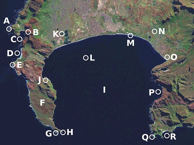
False Bay (Afrikaans Valsbaai) is a body of water in the Atlantic Ocean between the mountainous Cape Peninsula and the Hottentots Holland Mountains in the extreme south-west of South Africa. The mouth of the bay faces south and is demarcated by Cape Point to the west and Cape Hangklip to the east. The north side of the bay is the low-lying Cape Flats, and the east side is the foot of the Hottentots Holland Mountains to Cape Hangklip which is at nearly the same latitude as Cape Point. In plan the bay is approximately square, being roughly the same extent from north to south as east to west, with the southern side open to the ocean. The seabed slopes gradually down from north to south, and is mostly fairly flat unconsolidated sediments. Much of the bay is off the coast of the City of Cape Town, and it includes part of the Table Mountain National Park Marine Protected Area and the whole of the Helderberg Marine Protected Area. The name "False Bay" was applied at least three hundred years ago by sailors returning from the east who confused Cape Point and Cape Hangklip, which are somewhat similar in form.
False Bay is at the extreme western end of the inshore Agulhas marine ecoregion which extends from Cape Point to the Mbashe river over the continental shelf, in the overlap zone between Cape Agulhas and Cape Point where the warm Agulhas Current and the cooler South Atlantic waters mix. The continental shelf is at its widest in this ecoregion, extending up to 240km offshore on the Agulhas Bank, but is considerably narrower off False Bay. This ecoregion has the highest number of South African endemics, and is a breeding area for many species. The transition between the Agulhas ecoregion and the cooler Benguela ecoregion is at Cape Point, on the western boundary of False Bay.
False Bay also contains South Africa's largest naval base at Simon's Town (historically a base for the Royal Navy), and small fishing harbours at Kalk Bay and Gordon's Bay
-
1
Description and location
- 1.1 Coastal landmarks
- 1.2 Bottom morphology
- 1.3 Bathymetry
- 1.4 Geology
- 1.5 Waves, tides, water circulation and temperature
- 1.6 Water quality
- 2 History
-
3
Climate
- 3.1 Winds
-
4
Ecology and marine life
- 4.1 Algal blooms
- 4.2 Habitat types
- 4.3 Fauna
- 4.4 Seaweeds
-
5
Economic value
- 5.1 Extractive exploitation of resources
-
5.2
Recreational pursuits and tourism
- 5.2.1 Beaches
- 5.2.2 Surfing
-
5.2.3
Recreational scuba diving
- 5.2.3.1 Named dive sites
- 6 Naval base at Simon's Town
- 7 Development and human impact
- 8 Climate change
- 9 Research
- 10 See also
- 11 References
- 12 External links
Links
Images Gallery
-
 The Cape Peninsula seen from the West, False Bay (right) and Table Bay, with Robben Island (left). Compilation produced by NASA from Landsat and SRTM data. Vertical scale exaggerated.
-

-

-

-
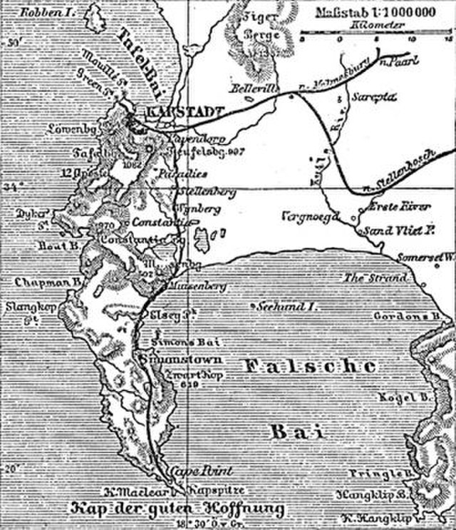
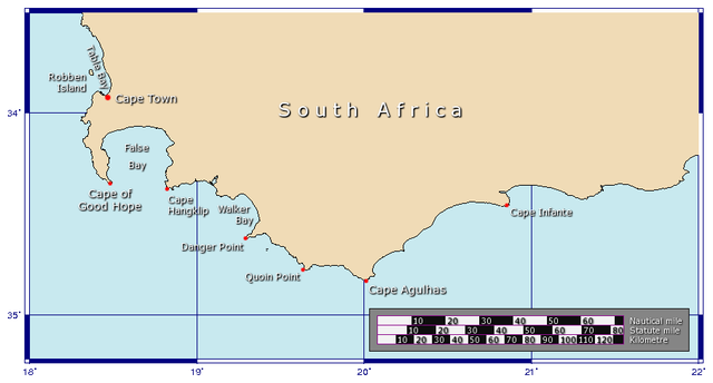 Map showing the locations of False Bay and Table Bay.
-

-

-

-
 Astronaut photo of Cape Town with False Bay
-
 View of City of Cape Town showing the Cape Peninsula and Cape Flats from the International Space Station
-
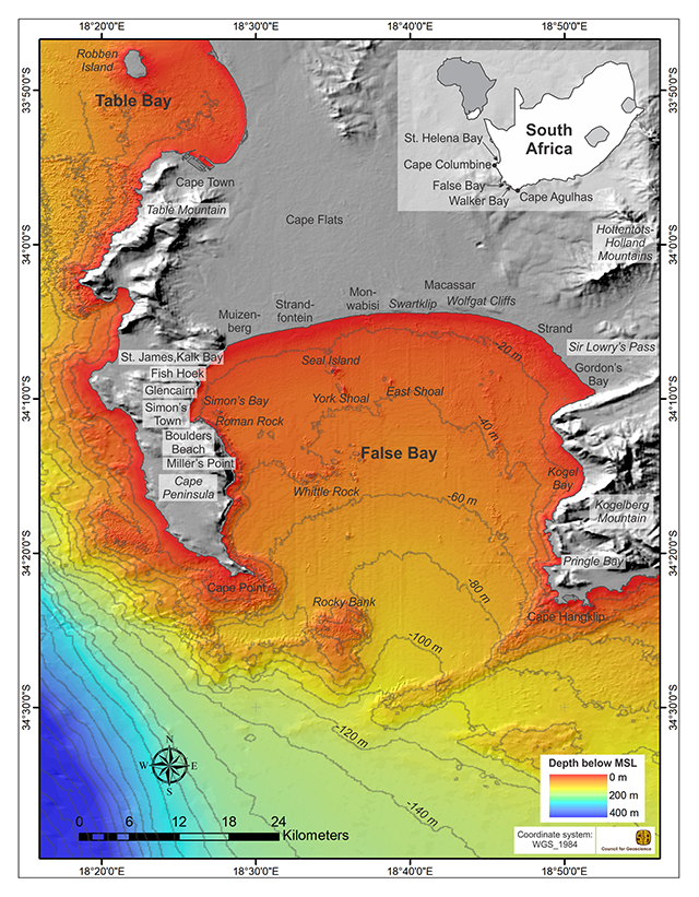 False Bay Bathymetry from SA Council for Geoscience
-
 Bathymetry of the Whittle Rock reef
-
 Charts of sea surface temperature in and near False Bay in summer and winter
-
 Surfers Corner; A popular surfing spot at Muizenberg in the northwest corner of False Bay
-
 Fish Hoek beach
-
 Boulders Beach
-
 Recreational scuba diving at Whittle Rock reef
-
 Map showing the distribution of most of the wreck and reef dive sites of the Cape Town local area
-
 A historic 9 inch gun overlooking False Bay installed at Simon's Town in the 1800s by the British to defend the bay.
-

-

-


Comments
Share your experience with others and write the first comment about the location