


Parque Nacional Natural Tayrona (Parque nacional natural Tayrona)
Der Parque Nacional Natural Tayrona (Tayrona-Nationalpark) ist ein kolumbianischer Nationalpark. Der Park liegt zwischen Taganga nahe Santa Marta und verläuft über ca. 35 km zwischen der kolumbianischen Karibikküste und dem Gebirge Sierra Nevada landeinwärts bis zur Mündung des Río Piedras im Osten. Der Park umfasst eine Fläche von 19.309 Hektar, wovon ca. 3.000 Hektar maritim sind. Der Park wird von der Schutzgebietsbehörde Parques Nacionales Naturales de Colombia betreut und wird bei der IUCN als Nationalpark (Kategorie II) geführt.Mit rund 250.000 Menschen jährlich ist er einer der meistbesuchten Kolumbiens. Dies führt zu Konflikten mit den auf dem Gebiet lebenden Indigenen.
Links
Images Gallery
-
 Strand im Nationalpark Tayrona
-

-

-
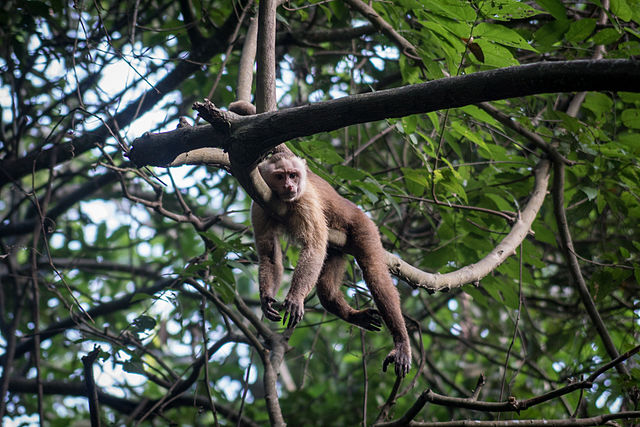 Santa-Marta-Kapuzineraffe im Nationalpark Tayrona
-
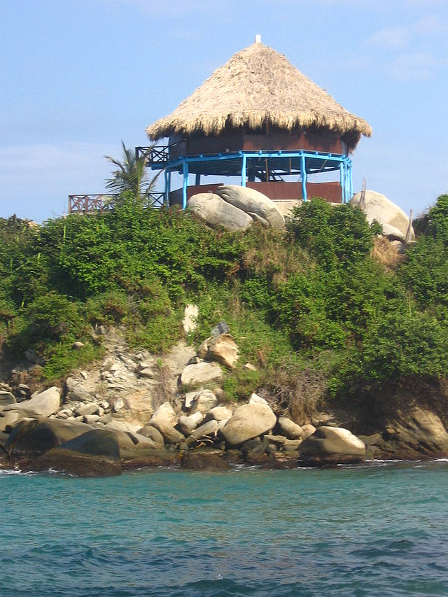
 El Cabo im Nationalpark Tayrona
-

-

-

-

-

-

-

-

-

-

Comments
-
Two and a half hours walk to the beach from the main entrance but totally worthy. Though you can arrive and/or leave by boat. Can visit some parts of the park in one day but if you can spend there more that one day you won't regret it.
a month ago -
This park is a natural treasure, full of biodiversity and beauty. Awesome views and paradise beaches. The perfect place to reconnect with the nature.
a month ago -
-
Great place to visit. The hike in is great if you like to walk. Could be a little challenging if not. It's approximately 7km each way if you decide to walk. You can also take a horse one of the directions or both if you choose. You will come across indigenous people also lots of wildlife such as monkeys and crocodiles! And then time to relax at the beautiful beaches!
7 months ago -
It was pretty cool. I'd advise people to spend the night, tho. It's a 2.5 hour walk after they drop you off at the parking lot (they ride was 5,000 pesos), so it's good to be able to relax. They recommend to go back at 3, so you can catch a bus back to Santa Marta.
2 weeks ago -
The Tayrona National Natural Park (Spanish: Parque Nacional Natural Tayrona) is a protected area in the Colombian northern Caribbean region and within the jurisdiction of the city of Santa Marta, 34 kilometres (21 mi) from the city centre. The park presents a biodiversity endemic to the area of the Sierra Nevada de Santa Marta mountain range, featuring a variety of climates (mountain climate) and geography that ranges from arid sea level to 900 meters above sea level. The park covers approximately 30 square kilometres (12 sq mi) of maritime area in the Caribbean sea and approximately 150 square kilometres (58 sq mi) of land.The Tayrona National Park was created by the 191st Law of the Colombian Institute for Agrarian Reform (INCORA), in order to guarantee the protection of the region and the preservation of the ecological environment
7 months ago -
-
Great! It's not an experience for everyone, if you are not used to Walking a few hours or ride a horse for at least one hour it can be somewhat harsh. The park has a lot of beaches, you can not swim in all of them, but there are designated places where you can. Do your research before you go, look at the map and the distance from the entrance of the park to your hotel and from your hotel to the beach. Food can be somewhat expensive but you can bring food into the park.
3 weeks ago