Source:
Wikipedia
Tidal Basin
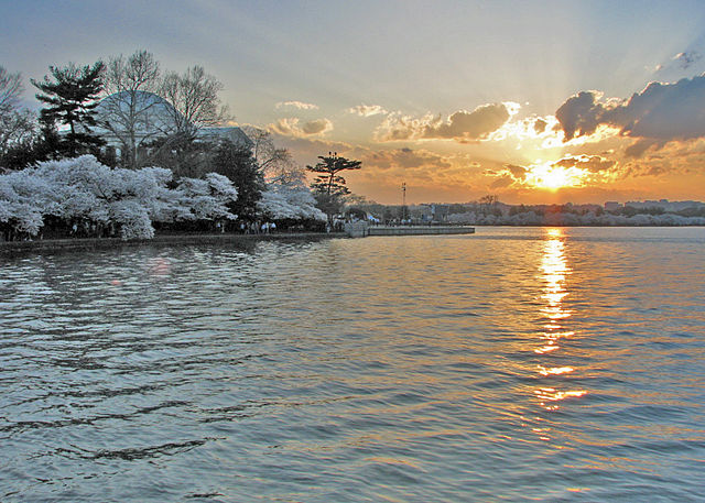
Le « Tidal Basin » est un bras de rivière partiellement aménagé par l'homme, adjacent à la rivière Potomac à Washington DC
Il fait partie du Parc de Potomac Ouest et est entouré par le Jefferson Memorial et du Franklin Delano Roosevelt Memorial.
Le bassin couvre une aire d'à peu près 107 acres (0,433 km2) et a 10 pieds (3,048 m) de profondeur.
Le concept du « Tidal Basin » date des années 1880 pour servir à la fois de pièce d'eau
et de bassin de contention du Canal Washington, un port séparé de la rivière Potomac par des terres émergées où se situe le Parc de Potomac Est.
Peter Conover Hains, un officier ingénieur de l'Armée US, en supervisa la conception et la construction.
- 1 Notes
Links
Images Gallery
-
-
 Le (en)« Tidal Basin » dans les années 1920
-

-

-
-

-

-

-
-
 Le (en)« Tidal Basin » avec des cerisiers en fleur
-
 Orphelins jouant dans le (en)« Tidal Basin » circa 1924
-
-

-

-

-

Comments
Warning: count(): Parameter must be an array or an object that implements Countable in /www/htdocs/w01ac264/geo.io/cache/template/9d49048052681464cab33744e55c87efd2abb64d.file.comments.tpl.php on line 21
So far there are no reviews about the location.
Share your experience with others and write the first comment about the location
Source:
Wikipedia
Tidal Basin
➴ Coordinates:
38° 53‘ N, 77° 2‘ W
Tags
Weather
9. Januar 2026
N/A °
N/A
N/A
N/A
Wind
N/A k/h
Humidity
N/A
Visibility
N/A km


