

 area constitutes the biosphere reserve, with the remaining forests outside the national park and wildlife sanctuaries being given the status of a primary reserve forest.")


")


Sundarbans National Park (सुंदरवन राष्ट्रीय उद्यान)
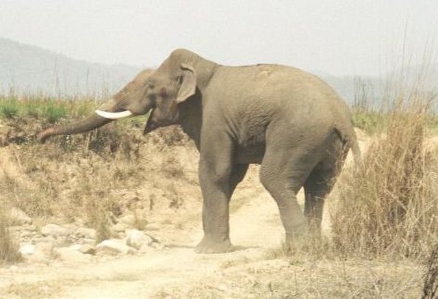
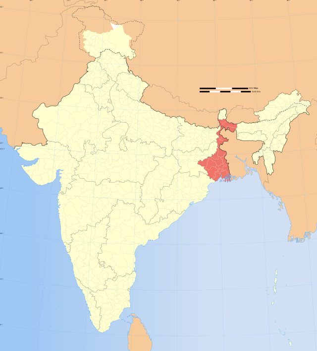
The Sundarbans National Park is a national park, tiger reserve, and biosphere reserve in West Bengal, India. It is part of the Sundarbans on the Ganges Delta, and adjacent to the Sundarban Reserve Forest in Bangladesh. The delta is densely covered by mangrove forests, and is one of the largest reserves for the Bengal tiger. It is also home to a variety of bird, reptile and invertebrate species, including the salt-water crocodile. The present Sundarban National Park was declared as the core area of Sundarban Tiger Reserve in 1973 and a wildlife sanctuary in 1977. On 4 May 1984 it was declared a national park. It is a UNESCO World Heritage Site inscribed in 1987, and it has been designated as a Ramsar site since 2019. It is considered as a World Network of Biosphere Reserve (Man and Biosphere Reserve) from 1989.
The first forest management division to have jurisdiction over the Sundarbans was established in 1869. In 1875 a large portion of the mangrove forests was declared as reserved forests under the Forest Act, 1865 (Act VIII of 1865). The remaining portions of the forests were declared a reserve forest the following year and the forest, which was so far administered by the civil administration district, was placed under the control of the Forest Department. A forest division, which is the basic forest management and administration unit, was created in 1879 with the headquarters in Khulna, Bangladesh. The first management plan was written for the period 1893–1898.In 1911, it was described as a tract of unexamined waste country and was excluded from the census. It then stretched for about 266 kilometres (165 mi) from the mouth of the Hugli to the mouth of the Meghna river and was bordered inland by the three settled districts of the 24 parganas, Khulna and Bakerganj. The total area (including water) was estimated at 16,900 square kilometres (6,526 sq mi). It was a water-logged jungle, in which tigers and other wild beasts abounded. Attempts at reclamation had not been very successful. The Sundarbans was everywhere intersected by river channels and creeks, some of which afforded water communication throughout the Bengal region both for steamers and for native ships. The maximum part of the delta is located in Bangladesh.
- 1 Administration
-
2
Geography
- 2.1 Climate
- 2.2 Eco-geography, rivers and watercourses
- 2.3 Mudflats
-
2.4
Flora and fauna
- 2.4.1 Flora
-
2.4.2
Fauna
- 2.4.2.1 Avifauna
- 2.4.2.2 Aquatic fauna
- 2.4.2.3 Reptiles
- 2.4.2.4 Endangered species
- 2.4.2.5 Marine mammals
-
3
Management and special projects
- 3.1 Constraints
- 4 Park-specific information
-
5
Sunderban Tiger Reserve
- 5.1 Background
- 5.2 Damage from Cyclone Aila
- 5.3 Damage from Cyclone Amphan
- 5.4 Challenges
- 6 Transport
- 7 Ecosystem valuation
- 8 See also
- 9 References
- 10 External links
Links
Images Gallery
-

-

-
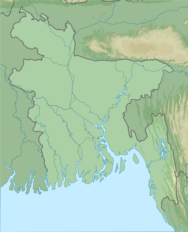
 Map of the protected areas of the Indian Sunderban, showing the boundaries of the tiger reserve, the national park and the three wildlife sanctuaries, conservation and lodging centres, subsistence towns, and access points. The entire forested (dark green) area constitutes the biosphere reserve, with the remaining forests outside the national park and wildlife sanctuaries being given the status of a primary reserve forest.
-
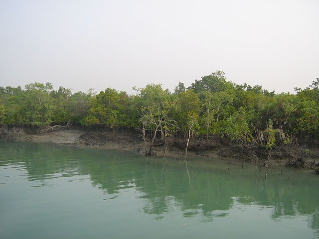
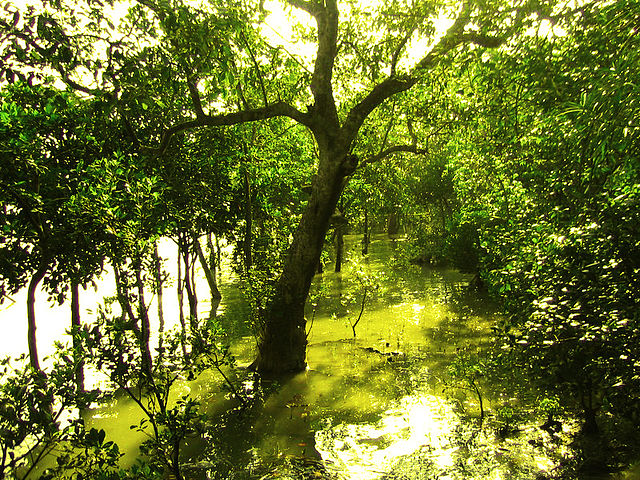
 Mangrove trees in Sundarban and a small creek going inside the forest
-
 Salt-water crocodile at Sundarbans
-
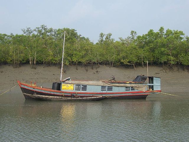 Patrolling boat in Sundarbans
-

-
 A tiger looks out from a forest of mangrove date palms.
-
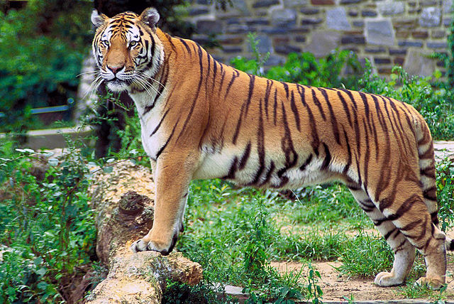
 A royal Bengal tiger in its natural habitat at sundarban
-
 Salt-water crocodile
-
 Entry to Dobanki Camp
-
 Closed jetty of Sundhanyakhali
-
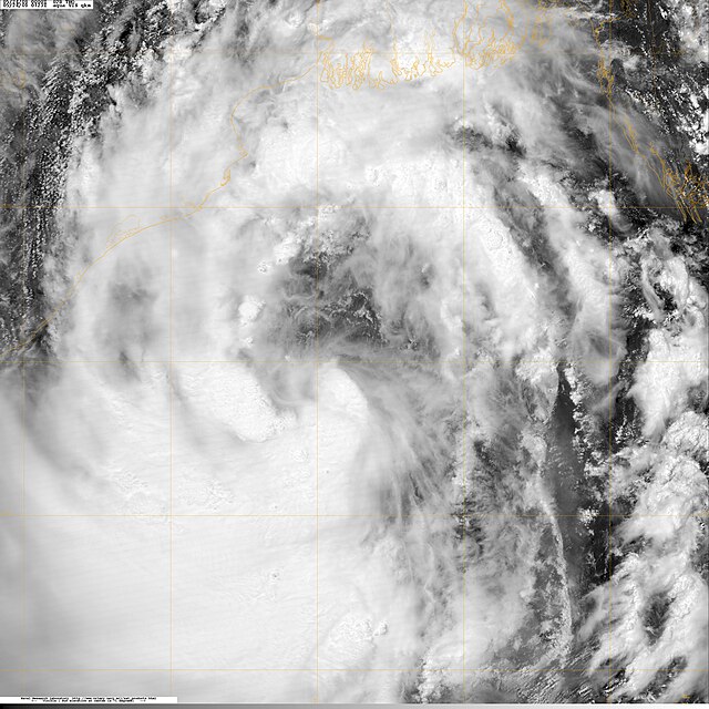 Cyclonic Storm Aila on May 24, 2009 (image by NASA)
-

-

-

-

-

-

-

-
-

-

-

-

-
-

-
-

-

-

-

-
-

-
-

-

-
-

-

-
-

-

-

-

-

-

-

-

-

-

-

-


Comments
Share your experience with others and write the first comment about the location