


 viewed from Hobsons Bay")


 and Dromana Bay in southern Port Phillip")


.")
Port Phillip
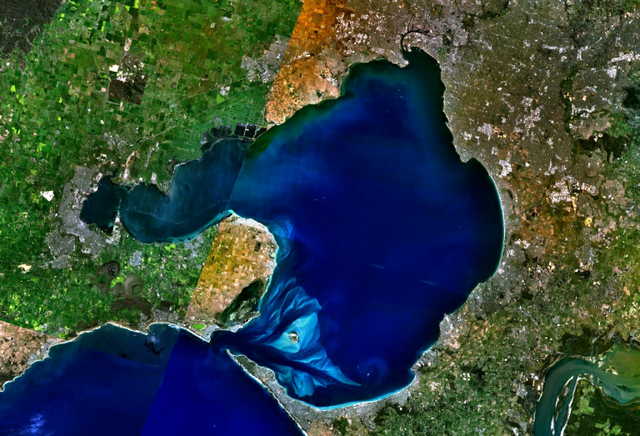
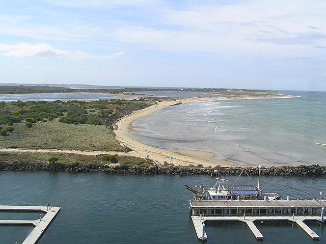
Port Phillip (Kulin: Naarm), also commonly referred to as Port Phillip Bay, is a horsehead-shaped bay on the central coastline of southern Victoria, Australia. The bay opens into the Bass Strait through a narrow channel known as The Rip, and is surrounded mostly by metropolitan Greater Melbourne in its main eastern portion north of the Mornington Peninsula, and the city of Greater Geelong in the much smaller western portion north of the Bellarine Peninsula. Geographically, the bay covers 1,930 square kilometres (480,000 acres) and the shore stretches roughly 264 km (164 mi), with the volume of water around 25 cubic kilometres (6.0 cu mi). Most of the bay is navigable, although it is extremely shallow for its size — the deepest portion is only 24 metres (79 ft) and half the bay is shallower than 8 m (26 ft).
Before European settlement, the area around Port Phillip was divided between the territories of the Wathaurong (to the west), Wurundjeri (north) and Boonwurrung (south and east) Nations. Its waters and coast are home to seals, whales, dolphins, corals and many kinds of seabirds and migratory waders.
The first Europeans to enter the bay were the crews of HMS Lady Nelson, commanded by John Murray and, ten weeks later, HMS Investigator commanded by Matthew Flinders, in 1802. Subsequent expeditions into the bay took place in 1803 to establish the first settlement in Victoria, near Sorrento, but was abandoned in 1804. Thirty years later, settlers from Tasmania returned to establish Melbourne (now Victoria's capital city) at the mouth of the Yarra River in 1835, and Geelong at Corio Bay in 1838. Today, Port Phillip is the most densely populated catchment in Australia with an estimated 4.5 million people living around the bay; Melbourne's suburbs extend around much of the northern and eastern shorelines, and the city of Geelong sprawls around Corio Bay, in the bay's western arm.
- 1 Prehistory
- 2 European exploration
- 3 British settlement
- 4 Growth and development of Melbourne
-
5
Geography
- 5.1 Climate
- 5.2 Beaches
- 5.3 Rivers and creeks
- 5.4 Islands
- 5.5 Surrounding mountains and hills
- 5.6 Surrounding lakes
-
6
Ecology
-
6.1
Original flora and fauna
-
6.1.1
Cetaceans
- 6.1.1.1 Burrunan dolphins
-
6.1.1
Cetaceans
- 6.2 Shellfish reefs
- 6.3 Environmental issues
-
6.1
Original flora and fauna
-
7
Shipping
- 7.1 History
- 7.2 Shipping channels
- 7.3 Shipping and cargo docks
- 7.4 Ferries
-
8
Other features
- 8.1 Flagship
- 8.2 Lighthouses
- 8.3 Shipwrecks
- 9 Tourism
- 10 Recreation and sport
- 11 See also
- 12 References
- 13 External links
Links
Images Gallery
-
 Endemic Burrunan dolphin in the bay
-

-
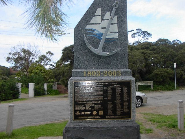 The memorial at Sorrento marking the site of the first British settlement on Port Phillip bay in 1803
-

-
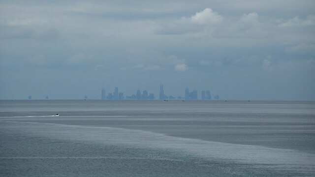
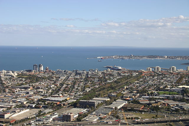
 Melbourne skyline (circa 2005) viewed from Hobsons Bay
-

-
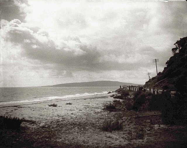 Anthony's Nose, Dromana, 1920
-
 1803 map by Charles Grimes of Port Phillip
-
 Beacon Cove beach and apartments in Port Melbourne
-
 Port Phillip as seen from Frankston on the eastern shore of the bay
-
 Arthurs Seat (305 m high) and Dromana Bay in southern Port Phillip
-
 Kitesurfing at Rye with Arthurs Seat in the background
-
 Jellyfish washed up on Port Melbourne beach
-
 Blue blubber jellyfish in Port Phillip
-
 The course of the Yarra River around 10,000 years ago, after the end of the last Ice Age, prior to the creation of Port Phillip.
-
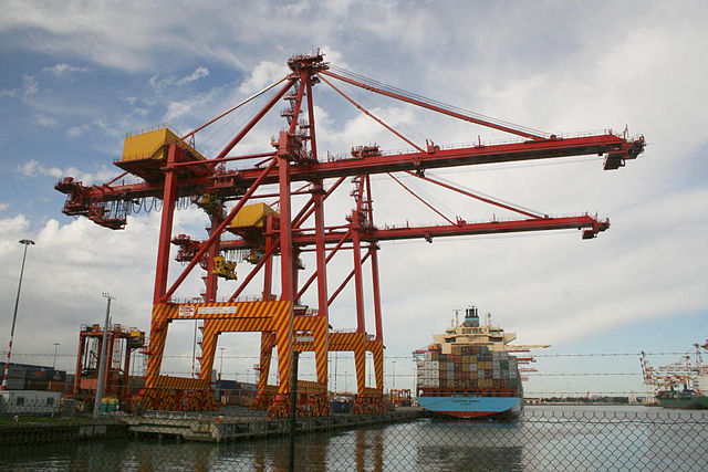 Container crane and ship at the Port of Melbourne.
-
 Port Phillip with Spirit of Tasmania ferry in port in Melbourne.
-
 Chinaman's Hat and Australian fur seals
-
 Elwood Beach & Port Phillip.
-
 Point Ormond near Elwood, Victoria (2009).
-
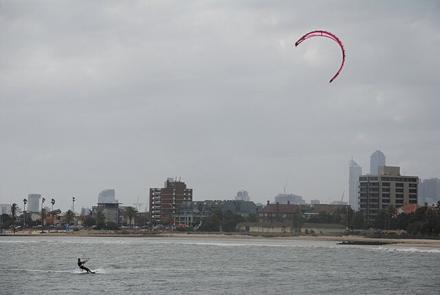 Kitesurfing at St Kilda on Port Phillip, Australia
-
-

-
-
-
-


Comments
Share your experience with others and write the first comment about the location