


.")


Omaha Beach
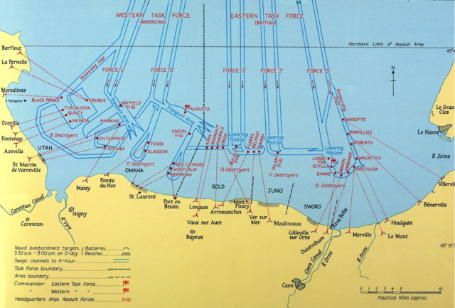
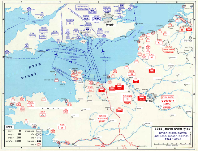
Omaha, commonly known as Omaha Beach, was the code name for one of the five sectors of the Allied invasion of German-occupied France in the Normandy landings on June 6, 1944, during World War II. "Omaha" refers to an 8-kilometer (5 mi) section of the coast of Normandy, France, facing the English Channel, from east of Sainte-Honorine-des-Pertes to west of Vierville-sur-Mer on the right bank of the Douve River estuary. Landings here were necessary to link the British landings to the east at Gold with the American landing to the west at Utah, thus providing a continuous lodgement on the Normandy coast of the Bay of the Seine. Taking Omaha was to be the responsibility of United States Army troops, with sea transport, mine sweeping, and a naval bombardment force provided predominantly by the United States Navy and Coast Guard, with contributions from the British, Canadian and Free French navies.
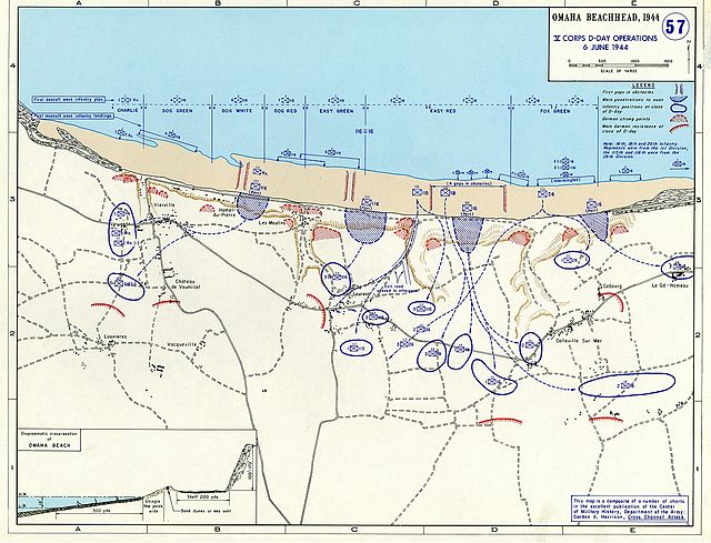
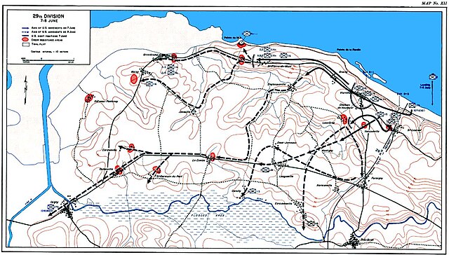
The primary objective at Omaha was to secure a beachhead eight kilometers (5.0 miles) deep, between Port-en-Bessin and the Vire River, linking with the British landings at Gold to the east, and reaching the area of Isigny to the west to link up with VII Corps landing at Utah. The untested American 29th Infantry Division, along with nine companies of U.S. Army Rangers redirected from Pointe du Hoc, assaulted the western half of the beach. The battle-hardened 1st Infantry Division was given the eastern half.
Opposing the landings was the German 352nd Infantry Division. Of its 12,020 men, 6,800 were experienced combat troops, detailed to defend a 53-kilometer (33 mi) front. The German strategy was based on defeating any seaborne assault at the water line, and the defenses were mainly deployed in strongpoints along the coast.
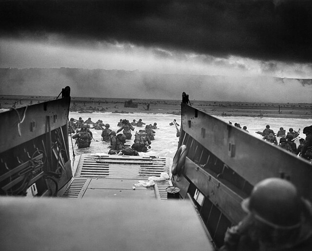
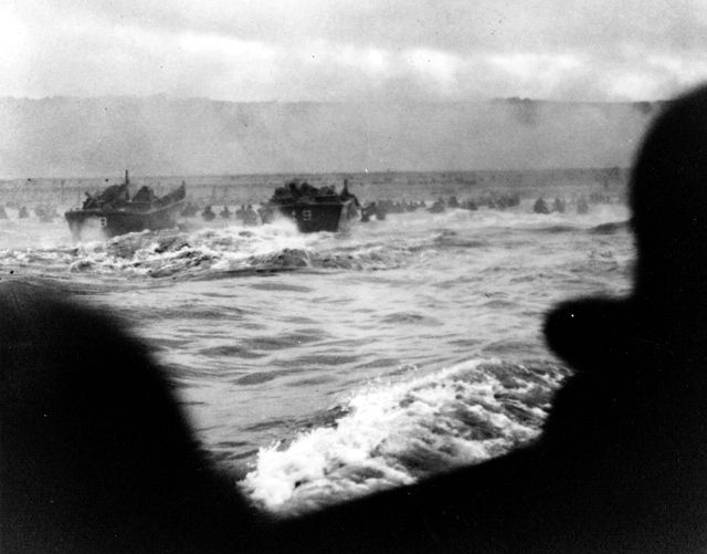
The Allied plan called for initial assault waves of tanks, infantry, and combat engineer forces to reduce the coastal defenses, allowing larger ships to land in follow-up waves. But very little went as planned. Difficulties in navigation caused most of the landing craft to miss their targets throughout the day. The defenses were unexpectedly strong, and inflicted heavy casualties on landing U.S. troops. Under heavy fire, the engineers struggled to clear the beach obstacles; later landings bunched up around the few channels that were cleared. Weakened by the casualties taken just in landing, the surviving assault troops could not clear the heavily defended exits off the beach. This caused further problems and consequent delays for later landings. Small penetrations were eventually achieved by groups of survivors making improvised assaults, scaling the bluffs between the most heavily defended points. By the end of the day, two small isolated footholds had been won, which were subsequently exploited against weaker defenses further inland, achieving the original D-Day objectives over the following days.
- 1 Terrain and defenses
-
2
Plan of attack
- 2.1 Naval component
- 3 Pre-landing bombardment
-
4
Initial assault
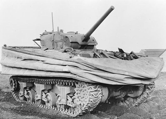
- 4.1 Tank landings
- 4.2 Infantry landings
- 4.3 Engineer landings
-
5
Second assault wave
- 5.1 American situation
- 5.2 German situation
-
6
Breakthrough
- 6.1 Assaulting the bluffs
- 6.2 Naval support
- 6.3 German defenses inland
-
7
Beachhead
- 7.1 German reactions
- 8 End of the day
- 9 Aftermath
- 10 See also
- 11 Notes
- 12 References
- 13 Further reading
- 14 External links
Links
Images Gallery
-
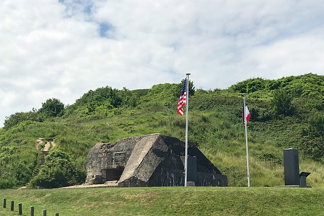
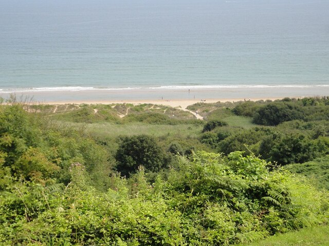
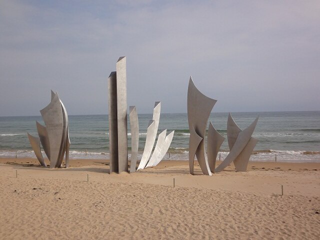
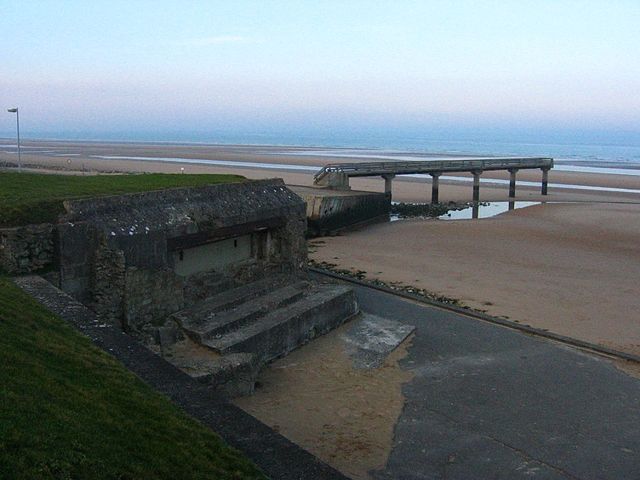
 Omaha landscape 67 years after landing. Harbor remains and "Les Braves" monument can be seen on the sand beach top edge.
-

-

-

-
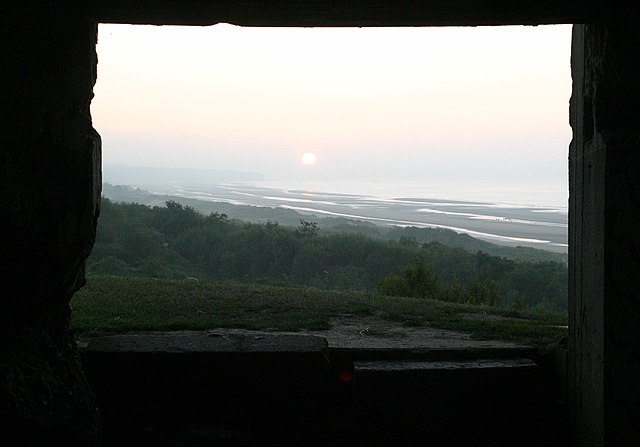
 Widerstandsnest 65 defending the E-1 draw at Omaha Beach
-
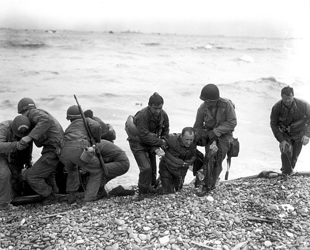
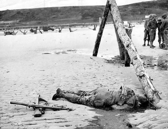 An American casualty of the morning's battle
-
 Tank turret mounted on a Tobruk at Widerstandsnest 68, June 1944
-
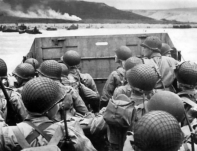
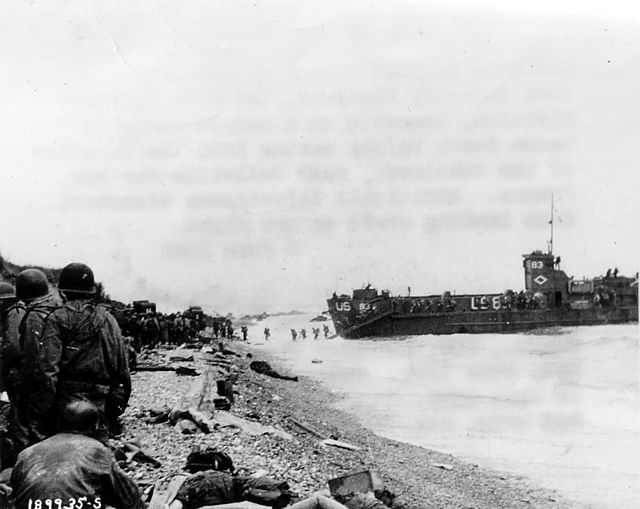
 Assault troops of the 3rd Battalion, 16th RCT, from the first two waves, shelter under the chalk cliffs (which identify this as an area of Fox Red).
-

-
 2nd Infantry Division troops and equipment going up the bluff via the E-1 draw on D+1, June 7. They are going past WN-65 that defended the route up the Ruquet Valley to Saint-Laurent-sur-Mer.
-

-
 Diagrammatic cross section of the beach at Omaha
-
 Official history map showing the V Corps objectives for D-Day
-
 USS Samuel Chase, infantry transport ship, part of Assault Group O1
-
 USS Arkansas engaging shore batteries off Omaha
-
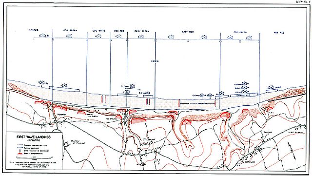 Official history map showing first assault wave landings
-
 Dog Green
-
 Dog White
-
 Dog Red
-
 Easy Green
-
 Easy Red
-
 Fox Green
-
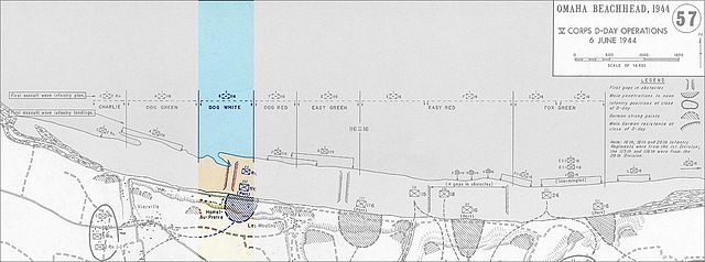
 Official history map showing the second assault wave landings.
-
 Aerial view of Omaha showing the draws, left to right; Vierville (D-1), Les Moulins (D-3), St. Laurent (E-1), Colleville (E-3) and "Number 5 Draw" (F-1).
-
 USS Frankford
-
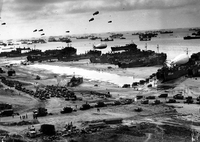
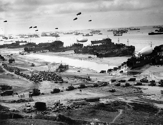
 Omaha on the afternoon of D-Day
-
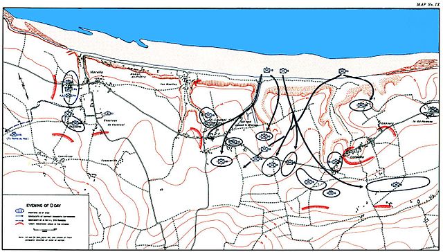 Official history map showing extent of advances made by evening.
-
 The Normandy American Cemetery overlooking Omaha Beach
-

-

-

-
-

-
-
-
-

-

-

-

-
-
-

-

-
-

-
-
-

-

-

-

-

-
-

-

-

-
-

-

-

-

-
-

-


Comments
Share your experience with others and write the first comment about the location