


Parco nazionale del Makalu-Barun (मकालु-बरूण राष्ट्रिय निकुञ्ज)
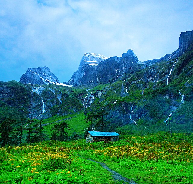
Il parco nazionale del Makalu-Barun (in nepalese: मकालु–बरुण राष्ट्रिय निकुञ्ज) è l'ottavo parco nazionale dell'Himalaya del Nepal; è stato istituito nel 1992 come estensione orientale del parco nazionale di Sagarmatha. Coprendo un'area di 1500 km2 nei distretti di Solukhumbu e Sankhuwasabha, è l'unica area protetta del mondo con un dislivello di oltre 8000 m che racchiude la foresta tropicale e cime innevate. La zona cuscinetto adiacente al confine meridionale e sud-orientale del parco copre un'area di 830 km2.Le aspre vette del Makalu, con 8463 m di altezza è la quinta montagna più alta del mondo, Chamlang (7319 m), Baruntse (7129 m) e Picco Mera (6654 m) sono incluse nel parco nazionale. L'area protetta si estende per circa 66 km da ovest a est e per circa 44 km da nord a sud. Dalla valle del fiume Arun a sud-est, situata ad un'altitudine di 344-377 m, l'altitudine guadagna circa 8025 m fino alla cima del Makalu. Il parco nazionale condivide il confine internazionale a nord con la Riserva naturale nazionale di Qomolangma nella regione autonoma del Tibet.L'area protetta fa parte del sacro paesaggio himalayano.
- 1 Storia
- 2 Clima
- 3 Flora
- 4 Fauna
- 5 Note
- 6 Altri progetti
- 7 Collegamenti esterni
Links
Images Gallery
-

-
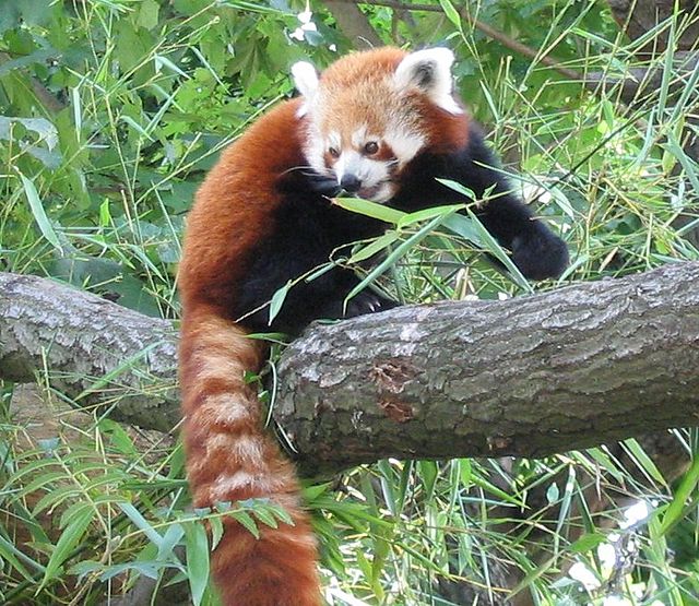 Panda Rosso
-

-

-
 Rhododendron arboreum – l'emblema floreale del Nepal
-

Comments
-
-
Beautiful place, highly recommend this place for trekking
2 years ago -
A National park in Nepal in the lap of Makalu Peak. Many visitors from national and international, go for treaking upto Makalu Base Camp. It takes 6-7 days to reach there(Makalu Base Camp). Way is rocky and step. Nice view of hamalayas, flora and funna.
a year ago -
Treking in height attitude... Wildlife animals..plant,beautyful veiw of himalayan..save diffrent rare animal of himalayan wildlife Vist Nepal 2020
a year ago -
-
Didnot enter the park, only till the outskirts to see the Arun hydropower project. Good to spend 15/20 mins there and see the Arun river. No bathrooms or eateries around. To enter the tunnel, early morning trip advised as work begins at 8. If u reach before 8, can walk the tunnels
2 years ago -
Went from gola to hatiya one day trek cardamom trek wide beautiful landscape and the trail with the sound of arun river following each footsteps was worth the pain for the trip abd the people there were too good
3 years ago -